Attempted on Sept. 13th, 2013.
Text and Photos by: Melissa Buehler
The American Alpine Club awarded me a grant in 2013 to attempt the Evolution Traverse in a day. It’s big feat and a lifetime goal for me, so I was extremely excited when I found out that I had won the money. Although it wasn’t much money, it gave me the motivation to get organized and focused on planning an epic road trip later that summer.
I was set to leave at the beginning of July, but my trip was delayed because I was granted an interview at a local University for a physical therapy program. I had moved to the East the year prior to complete the coursework and observation hours for Physical Therapy admission. That summer, I was offered an interview at my top choice school and although it jeopardized my chances of getting out to the Sierra in time for long days and stable weather, I decided getting into school took precedent. My trip was pushed back to depart at the beginning of August.
August 4th, 2013: Departure.

Emily, Loren and I at Wild Iris outside of Lander, WY.
I left Asheville , NC, with my two friends in tow. We took ten days to travel across the country, stopping by Spearfish Canyon in South Dakota and Tensleep, and Lander, both in Wyoming. We wanted to climb the country’s best limestone and did we. With a minor set back in Chicago (we had to go see this giant bean) and one in Tensleep (my radiator blew a hole), we finally arrived in Truckee, California on August 15th. The girls caught a plane out of Sacramento, and I was left to start my long journey of acclimatization and preparation.
August 15th, 2013: Tahoe

Me on top of Diamond Peak, Tahoe.
In order to acclimatize, I started in the Tahoe Basin. I climbed my favorite “after work” peak outside Emerald Bay called Maggie’s Peak. It felt great to be back in an area that I had lived and spent so much time in. Tahoe is where I learned how to navigate through the mountains on my own, having lived there in summer 2009, fresh out of college. I also spent time climbing at Donner’s Summit and bagged Mt. Rose before I headed to Yosemite Valley to escape from the smoke from a nearby fire.
August 21st: Yosemite Valley
But, the smoked followed me to Yosemite. My friend Ashley and I climbed the Rostrum together and then I headed up to Tuolumne Meadows. The big Yosemite “Rim” fire had started the day before I arrived to the Valley and when I got up to the Meadows, I found it to be smoked out. I got out of there and headed to Bishop, California.
August 25th: Bishop

My friend, Katie, on the ridge of Emerson.
My friend from Tahoe came down to meet me and we climbed Emerson Peak together. I was feeling really good up at 13,000’ elevation and my hopes of being able to send the Evolutions returned. Prior to this, I was feeling very sluggish and was having difficulties recovering from large physical exertions.
August 31st: Justin Arrives.
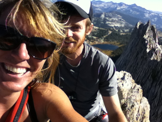
My boyfriend from Asheville wanted to climb with me out West this fall, so he flew into Sacramento at the end of the August. We first spent time at Lover’s Leap and then when went to Tuolumne Meadows once the smoke at the Leap became unbearable. We lucked out in Tuolumne Meadows, the winds had shifted and the meadows were smoke free and 120 was closed. It felt like we had the meadows to ourselves, no Bay Area traffic. We climbed Cathedral Peak and Matthes Crest and then went to Bishop at the end of the week and climbed at Pine Creek Canyon.

Justin and I on top of Matthes Crest.
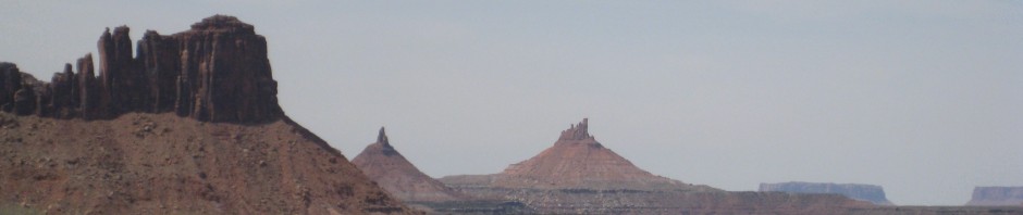
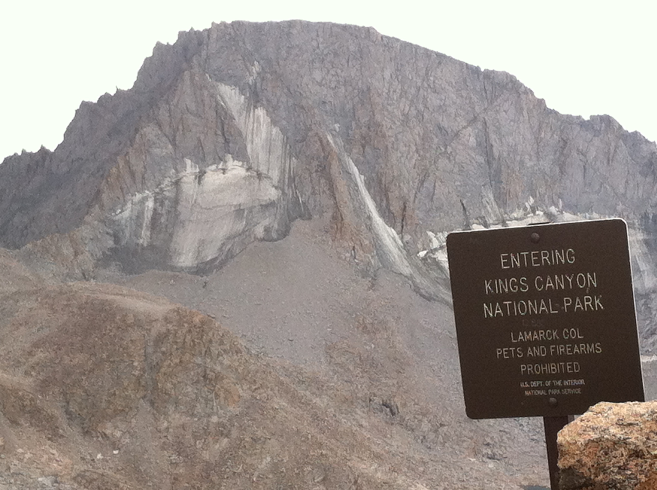
September 13th: Lamark Col.

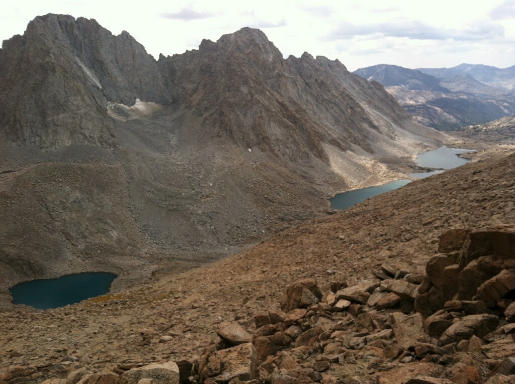
Looking back at Lamark Lakes.
The plan was to hike up there on Friday, rest on Saturday and then attempt the traverse on Sunday. I packed with me: a 35m rope that was 8.7mm in diameter, 30’ of webbing, a set of nuts, a single set of Black Diamond C4 cams from the range .3 to 1, and three extendable slings. I also threw in my climbing shoes and a harness, belay device and gri gri (incase I need to rope solo sketchy section). We also had a BD ultra light tent and a Jetboil to cook with. I had to borrow a bright headlamp to climb with and a BD Spot to use around camp and for back up. I had my BD Blast backpack to use while climbing and a 2.0 liter Camelbak for water. I also packed shotblocks, Powerbar Gel Packets and Dry Salami to eat on the climb. For clothing I had softshell Patagonia plants, Icebreaker Long Underwear, a Cap 1 tshirt, a R1 hoodie, my Arcteryx Atom Jacket and a Rab ultralight down jacket.
The weather had been getting cold at night, even at lower elevation, so I was concerned and felt rushed about getting out there to start. There had been a series of storms that were popping up each week in the Sierra, so when I saw a window, I decided to go for it.
The hike up turned out to be brutal and more than what we were ready for. Justin accompanied me for the approach and we were both weighed down with at least 40lbs of weight on our backs.
We got our approach beta mainly from zeedub from Cascade climbers (http://cascadeclimbers.com/forum/ubbthreads.php?ubb=showflat&Number=1077546) and Harihair’s comment on mountain project (http://www.mountainproject.com/v/evolution-traverse/107070687). I also consulted Peter Croft’s “The Good the Great and Awesome” book.

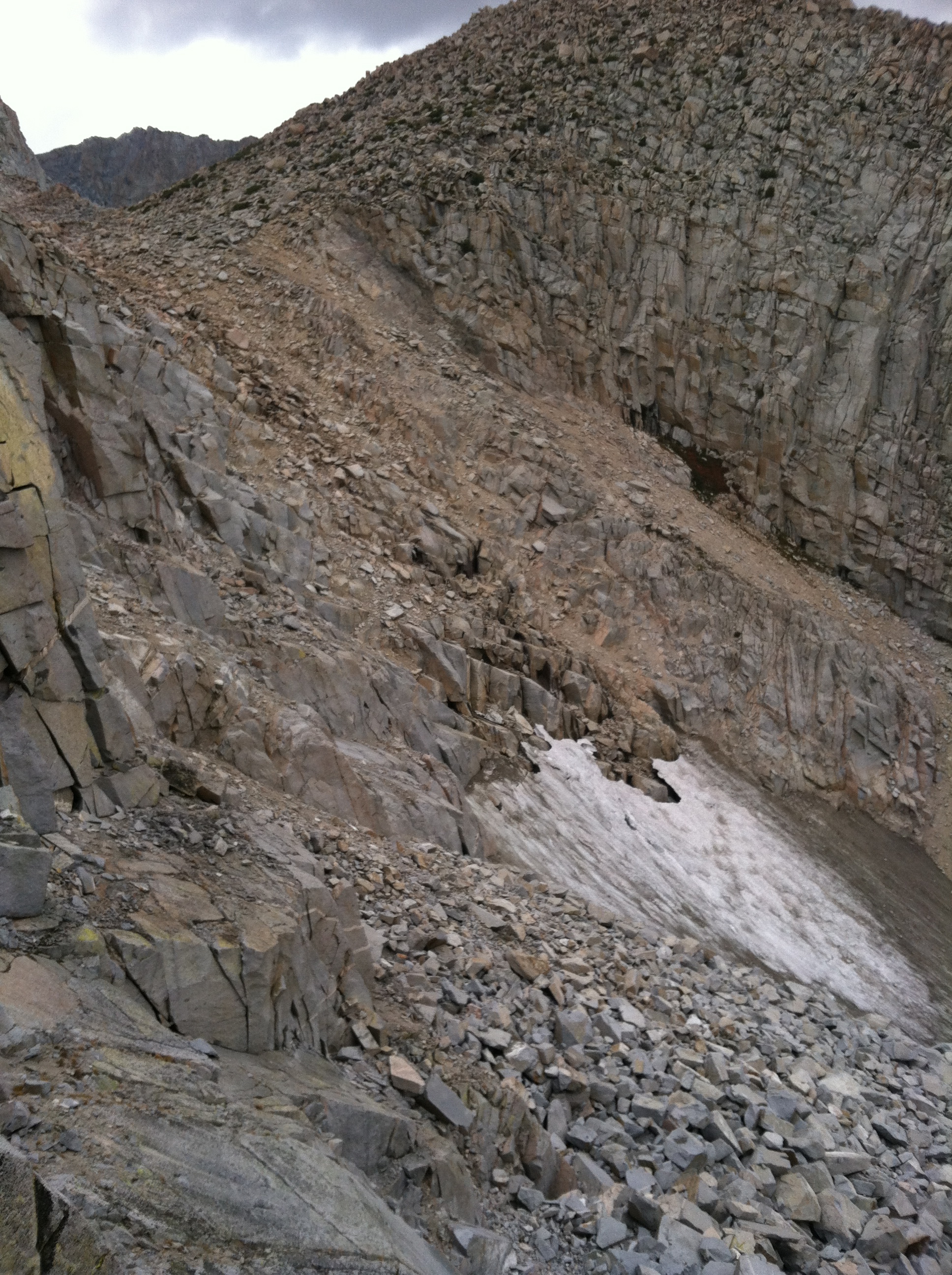
This is the sketchy fourth class section we went through. Do not go this way. If you start heading through a boulder field, turn around! Take the trail!!!!
It turned out the approach wasn’t as straightforward as we were led to believe. We begin hiking up Lamark Lakes trail and we followed the trail past two lakes. We followed this trail until it petered out at a tarn and then headed up and left from there. We came across some cairns which led up right, through a large boulder field which bottlenecked at a snow/ice patch. After what felt like hours navigating a half-mile through this boulder field, we came to the ice field and skirted left of up, hoping to find an easy way to ascend the ledges that were looming above us. We found a fourth class way through some sketchy rock, having to pass the packs through the worse of it. This was clearly not the Col. as we had hoped, but just the start of the pass towards the Col. After seeing some hikers up there heading a different direction than from where we came, we figured out that we went the wrong way.
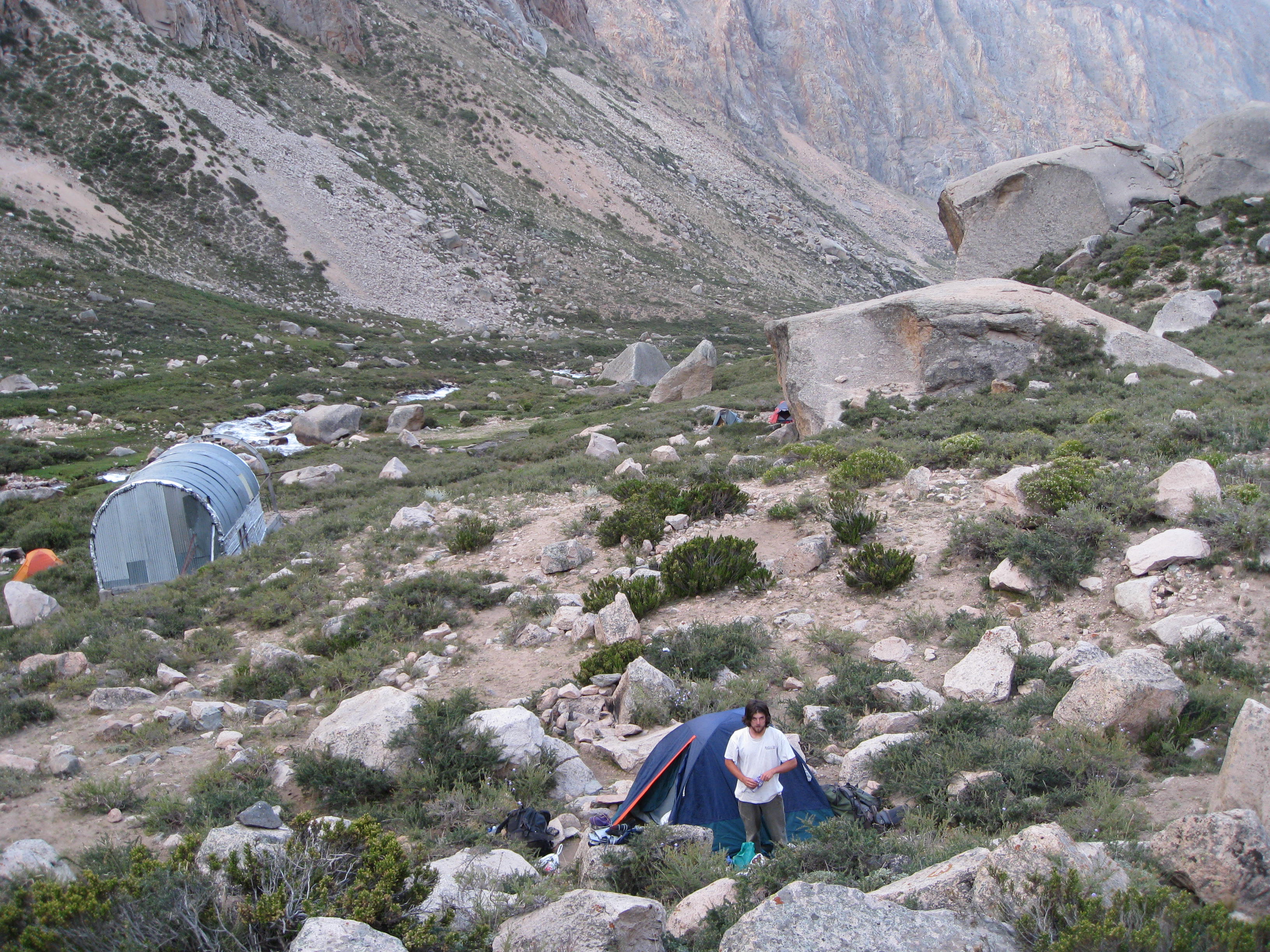
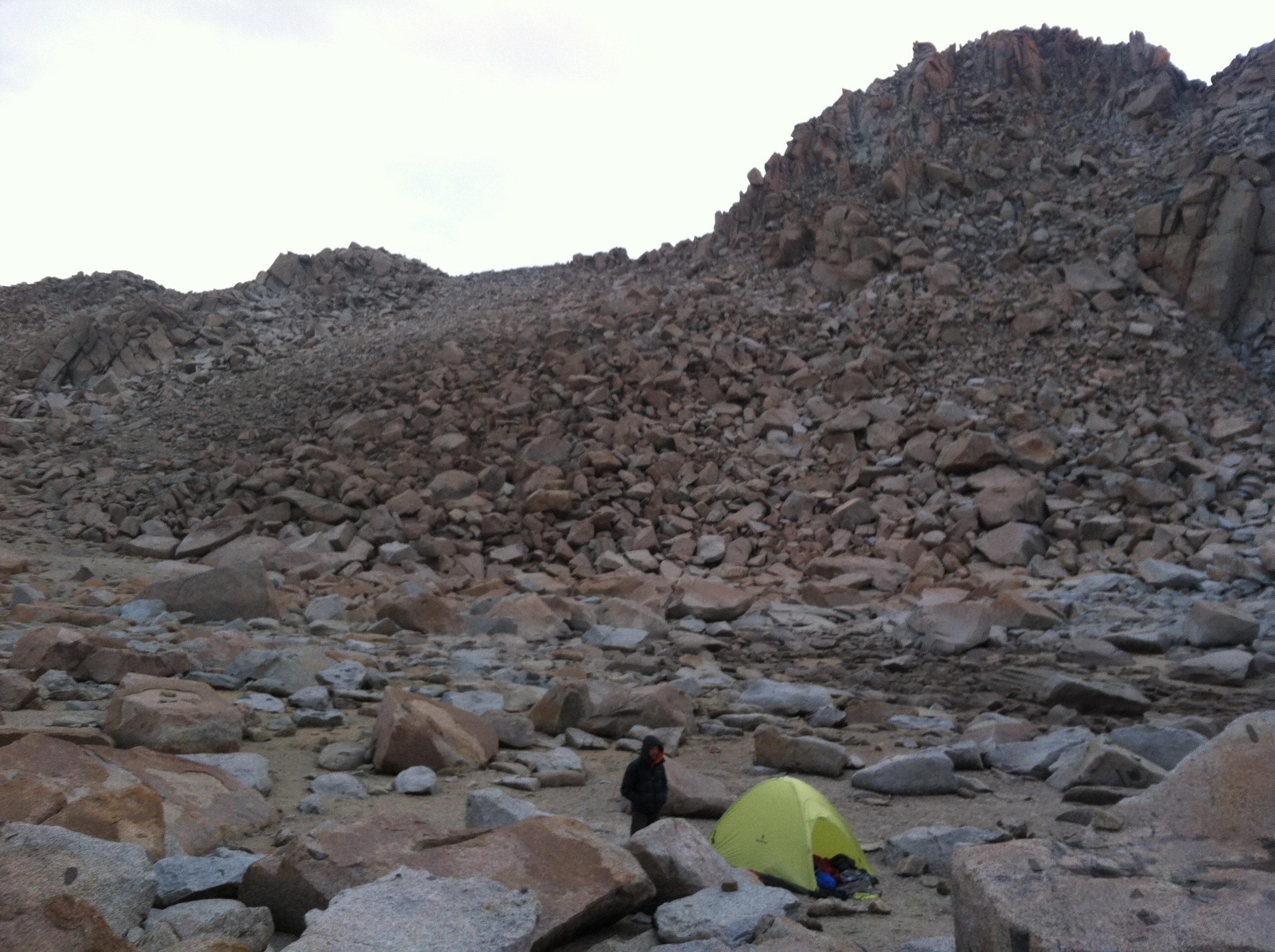
We finally arrived at the Col. around sunset and decided to wait to do the decent into Darwin Canyon for tomorrow. There were nice camping spots in a dried up lake bed and a source of silt-y water. We quickly threw up our tent and crawled into our sleeping bags . It was freezing cold up at 12,900’ once the sun had set. Later that evening it started sleeting on us, but luckily not enough to make us get out of the tent to cover our packs.

Our Campsite.
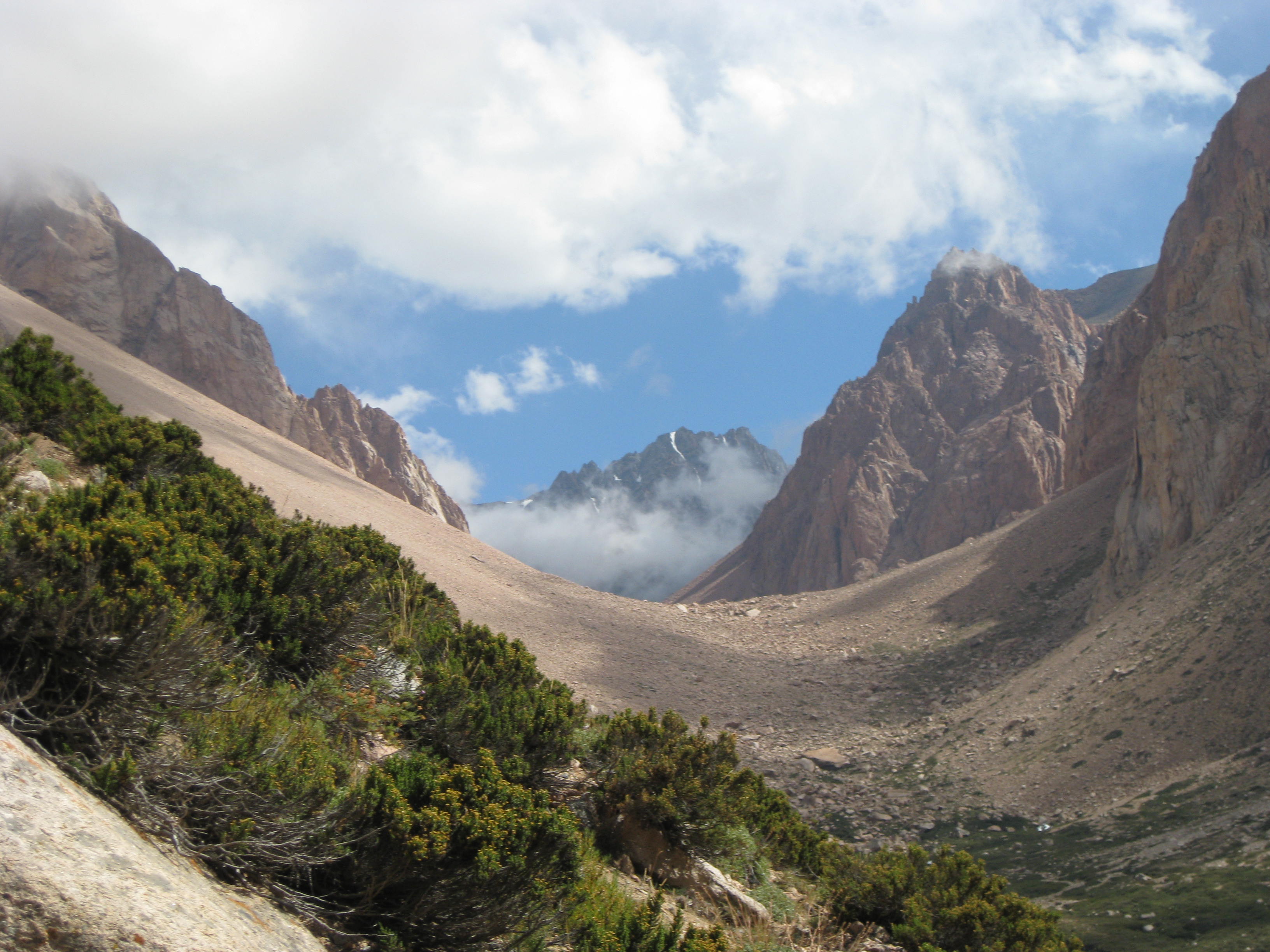
In the morning, we took our time getting moving. Originally, this was planned for a rest day, so I didn’t see any reason to rush things. Once we got all packed up and moving again, we ascended the side of the bowl that looked easiest to climb and had a feint trail that went up it. Once we reached the ridge and looked down, I noticed things looked different than what I had expected. But, there were social paths leading the way down and left, so we slowly started our way down. After almost making it through the chutes, I could clearly see that there was a massive ridgeline that blocked us from Darwin Canyon, and we had gone down the wrong side of the Col. We came to terms with this and slowly made our way back up the 3rd to 4th class choss chute to the top again. This was detrimental to our psyched. We had already used almost all our energy the day before and now we had wasted at least an hour and a lot more energy on yet the wrong way, again.

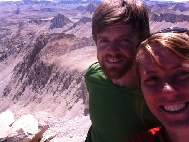
Mt. Darwin from the Col.
After reflecting on all the energy we had already spent to just make it to the Sierra Crest, we had to re-evaluate what we were getting into. We had already gotten lost several times and felt under-prepared for such a large goal. The days were short and weather was spotty, so we decided to call it off. We dropped the packs off and scrambled over to the Col. to gaze down on Darwin and the Evolution Basin.
Sept. 20th: Back to the West side
We finished up the summer alpine season on Bear Creek Spire and then we went to check out Shuteye Ridge. It turned out to be another adventure in an unknown area, with tricky approaches, both car and by foot, and sharing the place with a bunch of bear hunters. The rock and the views were good and its worth going back to, but maybe with a truck with four-wheel drive and hig clearance.
In retrospective, I should have done a recon mission up Lamark Col. before carrying heavy packs. I also need to do the Traverse earlier in the year, mid September is late for such a big goal. Longer daylight hours and more stable weather in July/August is ideal. More training on long trails with weight would have been smart to do. Backpacking up such extreme terrain was more draining than I had anticipated. I think completing the traverse with a partner before attempting to do it in a push would be a good way of going about such a big feat of doing it in a day. Also, a better map would have probably helped keep us on trail, although the Lamark Col trail isn’t on many maps.
None-the-less, I had a great trip traveling out there with my friends from Asheville and returning with my boyfriend. I saw many old friends and places that I had come to love after living out there for so many years. My boyfriend also got to experience the part of the country that meant so much to me. Sharing this experience with him only brought us closer. We traveled from Bishop up to my college town in Humboldt and then back down and through Red Rocks, Zion National Park and Indian Creek. It was a great road trip that last three months. I probably wont have another chance to do such an extended road trip within the next couple of years because I was accepted into ETSU’s Physical Therapy Program, starting this January 2015!

Justin and I on top of Bear Creek Spire.